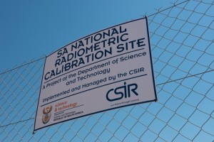
 The Paardefontein satellite radiometric calibration site has been established with Department of Science and Technology funding since 2011. The vicarious calibration site is established at Paardefontein because of the many benefits this location offers to these types of measurements.
Located far away from the ocean and other immediate sources of atmospheric aerosols, it is perfectly suited for a satellite radiometric calibration site. During the dry winter months, it is the best time to perform vicarious calibration, due to very low cloud cover and minimal rain.
An added benefit to researchers and clients is that Paardefontein is easily accessible on a daily basis from Gauteng, and not as remote as other calibration sites might be.
The main feature of the site is a 100 m by 100 m concrete paved area that is fenced and located on a high, flat area that is not subject to terrain effects such as flooding. The target provides a reference for radiometric vicarious calibration of satellite Earth Observation (EO) cameras. Paardefontein is a government owned property that is secured and operated by the CSIR, and offers additional area for the implementation of other types of small targets.
First field campaign
The first South African satellite radiometric calibration field campaign using the artificial vicarious calibration target at Paardefontein took place in July, 2014 for a two weeks period. The campaign involves full spectral characterisation of the target surface, as well as characterisation of the atmosphere and collection of other in-situ data. Subsequently, radiative transfer computations will be executed to infer the Top-Of-Atmosphere (TOA) spectral radiance above the target at the time of key satellite imaging overpasses. For successful completion of the vicarious calibration exercise, it is vital to obtain calibrated satellite imagery at sufficiently high spatial resolution and known spectral response of the target during the in-situ ground campaign.
The imagery will be used for comparing TOA spectral radiances measured by the satellite to those predicted from the radiative transfer computations. Providing comparisons that lie within the predicted uncertainty budget for the vicarious calibration process is sound evidence that the practitioners understand the relevant calibration and radiative transfer issues.
dpss@csir.co.za
